Colorado Weather
Well, to say that the weather in Colorado has been fickle this week is an understatement. Most of Colorado experienced some winter weather Monday into Tuesday!
DIA (Denver International Airport) officially received 3.7" of snow bringing our monthly total to 3.9" and our season total to 48.1". Normal season total to date is 53.8" so we are only slightly below that!
Also, with how wet it was across the state yesterday, I have an interesting fact. We picked up over an inch of liquid accumulation in the 24 hour period which is the largest daily precipitation amount since May 18, 2017! Go us.
As we move through the week, the weather will be calmer for most but we still will remain below average and wetter than normal.
Denver Summary:
Chance of showers Wednesday evening
Clearing and warming for Thursday through the weekend
Clouds and showers move back for early next week
Mountains Summary:
Snow showers continue through Friday AM
Clearing for the weekend
More rain/snow chances for early next week
The nitty gritty:
Tuesday night: there is a Freeze warning in effect. Make sure you bring in all of your sensitive outdoor vegetation so it does not get damaged. Temperatures will be hovering right around 32° by Wednesday morning.

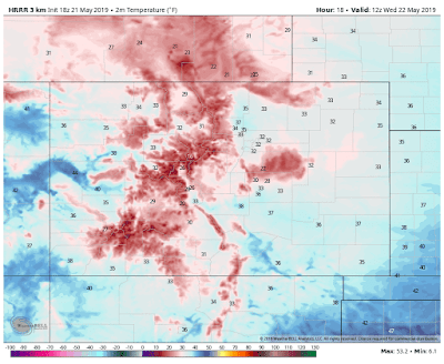
Now, Wednesday will be sunnier and warmer. I do see the chance for an isolated shower or thunderstorm by the evening but again, it'll be pretty isolated. Thursday should be our first dry day in a quick minute. Aside from lingering clouds (and an isolated shower in the AM) most of the day will feature nice sun and warming temps. Should reach into the 50s! Normal highs, mind you, are typically in the lowers 70s this time of the year.
Now to the weekend! Friday, Saturday and Sunday look fantastic. Enjoy a weekend filled with sunshine and temperatures eventually rising into the 70s!
Our next good chance for moisture in Denver will come next week. Monday through Wednesday are looking a little unsettled so keep that info in the back of your head.
The mountains are expecting more and more snow with cold temperatures continuing! Through the next several days, the mountains will likely pick up several more inches of snow.

Some of the higher peaks will get an additional 6-10" of snow through Friday morning! Adding to the extremely healthy snowpack we already have. This is just awesome news. All of the reservoirs will likely fill up to near normal levels because of all the moisture!
Looking longterm:
According to the CPC, we will stay in a slightly below average temperature realm for the next 10 days and a slightly higher precipitation realm for the next 10 days although the bulk of the moisture and the majority of the cold will be off to our west.
According to the CPC, we will stay in a slightly below average temperature realm for the next 10 days and a slightly higher precipitation realm for the next 10 days although the bulk of the moisture and the majority of the cold will be off to our west.
If you could help in sharing my posts, I would love it! I need to gain some recognition in the Denver area and if you would help, it would make my job a little easier.
That's all for now!
~ Rain or shine
I'm Andy Stein
I'm Andy Stein

Comments
Post a Comment