Thursday - June 20 - Weather Update
Today begins a busy stretch of weather. I know I mentioned that Wednesday and Thursday would be drier than the rest of the week. That was true for yesterday but not so much for today. Lots of storms are covering the state. The trough I'm watching is a little stronger, thus grabbing more moisture and bringing it earlier.
Severe storms will continue to be an issue through the end of the day.


Severe storms will continue to be an issue through the end of the day.
We still haven't hit 90º, which makes this the latest we've seen that temp since 1999. If we don't get a 90º day by the 25th, it'll be the latest 90º has happened since 1982. We'll likely get to 90º by the 26th or 27th.
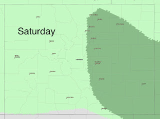
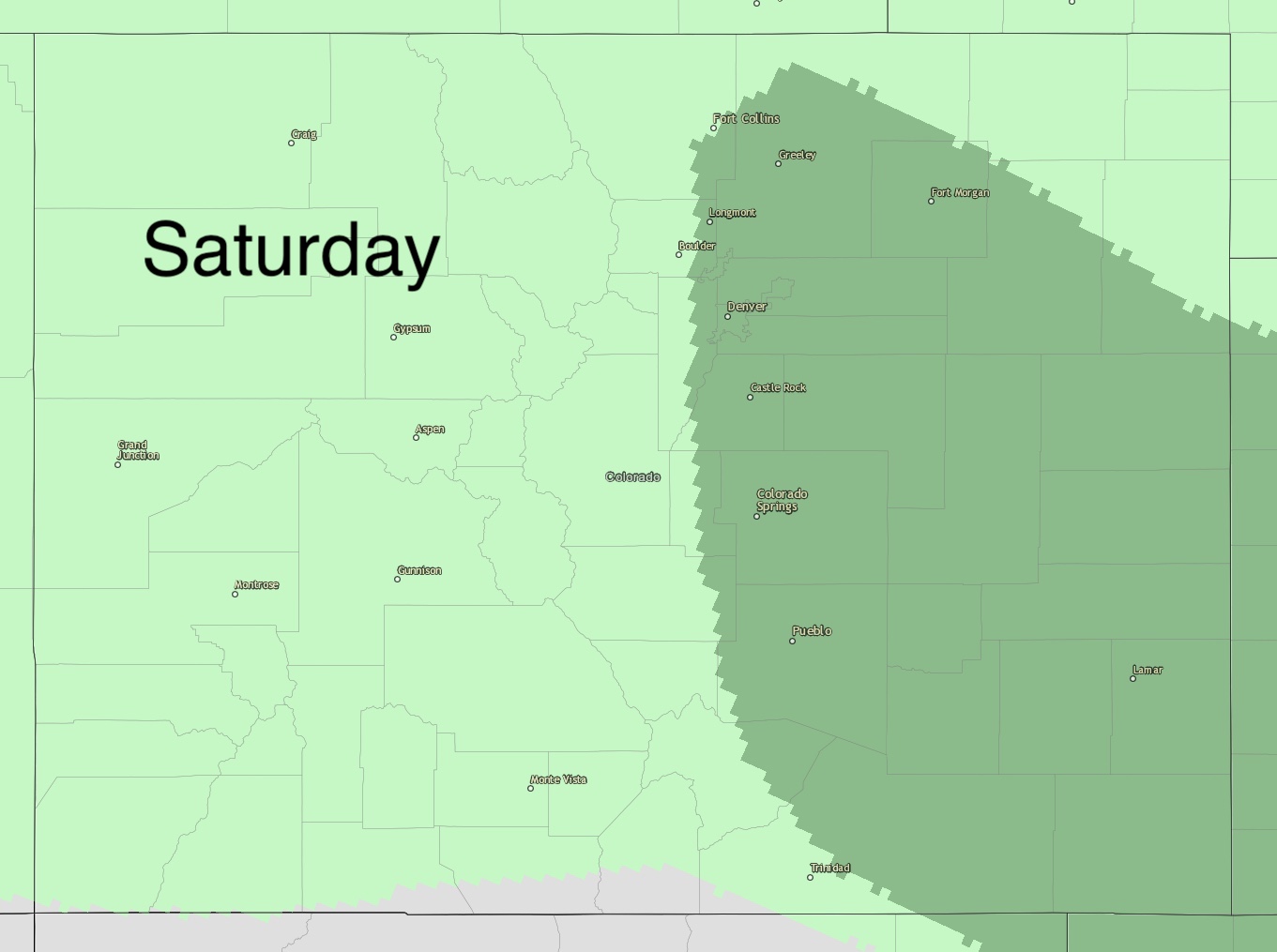
My forecast is holding steady for this weekend.
We'll see a big trough skirt across the state this weekend with a reinforcing shot of moisture and cool air for the latter half of the weekend.
We'll see a big trough skirt across the state this weekend with a reinforcing shot of moisture and cool air for the latter half of the weekend.
Scattered showers and storms are continuing on this Thursday.
By Friday, the front with be affecting the NW corner of Colorado. This will keep our winds coming from the SW. Downsloping winds will keep Denver warmer and dryer for a portion of the day but then we see an eruption of storms and once those get going, it'll be hard to turn off that moisture source.
By Friday, the front with be affecting the NW corner of Colorado. This will keep our winds coming from the SW. Downsloping winds will keep Denver warmer and dryer for a portion of the day but then we see an eruption of storms and once those get going, it'll be hard to turn off that moisture source.

Rain, heavy at times, with thunderstorms embedded, will be with us starting tomorrow and lasting all the way through Sunday pm.
We will see snow from this as well in the higher elevations and with the new model data, we may have some more snow a little more widespread rather than just the North Central mountains. Snow totals will be higher in the North-central mountains but I think all elevations above 10,000 feet will get a couple of inches of snow!
Watch for flooding. That's still a concern.

By next week, we will begin to really dry out and warm up. Highs WILL be in the 90s and lower 100s for the Plains of Colorado by the 26th-27th.
~Rain or shine
I'm Andy Stein
I'm Andy Stein


Comments
Post a Comment